Albania
Navy Hydrographic Service
A contribution by Lieutenant Kesjana Huda
The Albanian Hydrographic Service was founded on 25 September 1957, as a requirement of the Naval Force for the hydro-naval safety in the territorial waters.
The mission is to provide navigational, hydrographic and oceanographic services and products, to monitor and maintain technical safety through navigational lights within the Albanian territorial waters in accordance to internationally agreed standards.
The legal basis of the Albanian Hydrographic Service is defined in the Maritime Code of Republic of Albania, law No. 9251, Date 08.07.2004, article 14:
• AHS is a state technical and scientific institution in composition of the Albanian Navy, that directs, organizes and processes the publications of nautical charts and other navigations documents including aids of navigation signals.
• AHS conducts hydrographic and hydrological studies of the sea and relief. It publishes and provides the necessary documentation for all marine Albanian vessels, such as warships, transport, fishing and tourism.
• AHS with the authorization of the Ministry of Defence interacts with hydrographic services and institutions of foreign countries for the purpose of study and activity coordination.
The main tasks of AHS are:
• To repair and maintain all navigational equipment located along the coast and in the lakes of Albania.
• To plan and conduct hydrographic surveys.
• To perform hydrographical and hydrological studies within territorial waters of Republic of Albania, including the optimal positioning of navigational lights, beacons, buoys and signalling equipment.
• To collect bathymetric data and define sea bottom topography in order to produce nautical charts and documents.
• To evaluate and compile all the results obtained from hydrographic surveys and other data sources.
• To collect necessary information to produce nautical documentation of coastal areas.
As the main servicing resources of the AHS are three small vessels:
• Small tug boat used for repairing and transportation of buoys.
• 12 metre small hydrographic boat, equipped with hydrographic equipment, full bathymetric survey capabilities.
• Small motor vessel used for repairing AHS costal buoys.
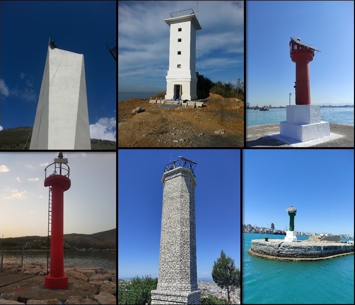
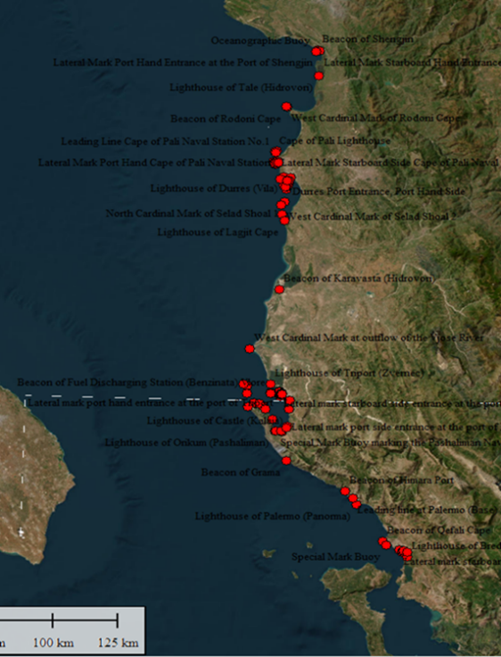
The coastline is well-covered by lights from Ksamili to Kepi (Cape) Stillos. In total are 93 aids to navigation being 53 marine lanterns/lighthouses and 40 navigational buoys.
As one of the main task of the AHS is also the issue of the Notice to Mariners to ensure the safety of life at sea, the information published in the Notice to Mariners is designed to provide the correction of Hydrographic Products, Albanian Sailing Directions for Adriatic and Ionian Seas, List of Lights, and other related nautical publications produced by AHS. AHS is able to deliver Local Notice to Mariners published by the Navy and also through the Spain Hydrographic Service (NAVAREA III Warnings).
The main priorities of AHS for the future are:
• Following the instructions and standards defined by the IHO.
• Full cooperation with, and participation in, IALA.
• Training of personnel in regard to Aids to Navigation at all levels.
• Trainings of the personnel in the field of hydrography (Cat-A, Cat-B).
• Active participation in Capacity Building Committee Work Programmes.
• Completion with high-tech hydrographic equipment.
• Completion with a multi-functional ship.
• Production of ENC’s within AHS.
• Centre for remote management of navigational lights.
• Replacement and addition of modern navigational lights.
Picture captions
The Albanian Hydrographic Service organization.
Location of lights along the coast of Albania.
Examples of fixed and floating aids to navigation: lighthouses and buoys.
Editor’s note:
A 5:08 video showing the work of the IALA World-Wide Academy mission to Albania is available here:


Rapporteur: Paul Ridgway
